GIS Center Helps City of Silvis with Water Pipe Survey
July 28, 2022
MACOMB, IL – A project to meet a statewide mandate to replace lead water pipes in homes is resulting in hands-on GPS and GIS experience for Western Illinois University undergraduate and graduate students.
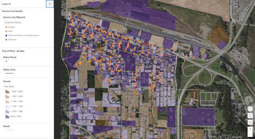
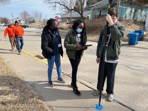
The GIS Center at WIU, headed by Director Chad Sperry, has partnered with the Rock Island County community of Silvis to evaluate water pipes that run from the city's streets into its more than 1,500 homes. The project is paying University students to go door-to-door, asking residents to examine the pipe coming into their home from the streets. Students then photograph the pipe, and the collected data is entered into a project database to keep track of the existence of lead pipes that need to be replaced with copper piping.
Silvis officials approached the University after seeking out a way to complete the work.
"This project helps with the students' interpersonal skills and their GIS skills," said Sperry. "Silvis officials made a Facebook post to notify residents that the students would be knocking on doors, and they wore city shirts with 'Silvis' on them, in an effort to alleviate concerns residents had. They also put an ad in the local newspaper asking residents to allow the students to come in."
The work began over WIU's spring break week with GPS equipment purchased for the project. That week, graduate students went home-to-home checking and photographing the pipes, then adding to the database. Students returned to the community earlier this summer, and a plan is being put together for a third visit.
"Collaborating with the WIU students has been so beneficial for the city of Silvis," said Silvis City Administrator Nevada Lemke. "As a small community, with limited staff resources, gathering material inventory for our entire community's water distribution system is quite challenging. The WIU students working on this project came to Silvis and went straight to work, gathering data and entering it directly into the GIS platform. Not only is this extremely helpful with gathering the required material data, but they are going above and beyond by entering locator data for other equipment in our distribution system which is building a more comprehensive GIS map for our community and improving the accuracy of it."
In addition to the legwork, the center built a manual so once the work is complete, Silvis' public works staff can access the online database to make changes and information is gathered about homes, or residents self-report the status of their water pipes.
WIU GIS graduate student Marcus Baptiste, of Grenada said he has made two trips to Silvis to work on the project. He said he learned a variety of skills while gathering information.
"I learned communication skills as we dealt with a variety of people on a day-to-day basis," he said. "We had to analyze the data and go back and add it to the database."
Sophomore GIS major Brad Mercer, of Granite City, IL, accompanied the group on the first data-gathering trip. He said he learned leadership skills, including doing training with Silvis' officials.
Sperry said a presentation on the project was delivered at the recent Illinois Public Works Association's conference, which has led to inquiries from other Illinois' cities. Travel time and lodging expenses are cost prohibitive to doing similar projects too far from Macomb.
The state of Illinois has given communities two years to complete an inventory of homes. There could be grant money coming to help replace the lead-based lines.
For more information on the GIS Center, visit wiu.edu/GIS.
Posted By: Jodi Pospeschil (JK-Pospeschil@wiu.edu)
Office of University Communications & Marketing


Connect with us: