University News
GIS Center Drone, Director Add Crime Fighting to Experiences
August 29, 2019
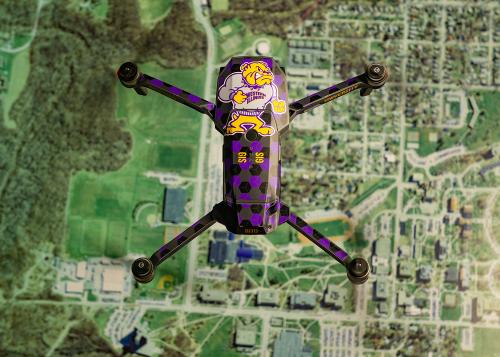
MACOMB, IL – The drones operated by Western Illinois University's Geographic Information Systems (GIS) Center have added crime fighting to an extensive resume of public service operations.
Earlier this month, GIS Center Director Chad Sperry used one of the center's two new drones to locate a Fulton County man who fled on foot from McDonough County Sheriff's deputies during a traffic stop. The man was initially found asleep in his car, and when he was woken up by a county deputy, he tried to flee in his vehicle. After a struggle with the deputy, the man was Tased and then ran into a cornfield near Tennessee, IL, just off U.S. Routes 136 and 336, at about 3:30 a.m. Aug. 8.
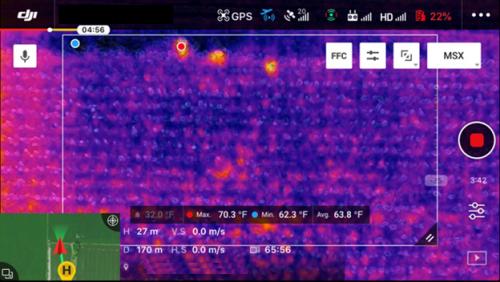
McDonough County Sheriff Nick Petitgout said a perimeter was set up around the 20-acre field by officers from his department, the Macomb Police Department, the Western Illinois University Office of Public Safety, the Hancock County Sheriff's Department and the Illinois State Police. Officers then called in Sperry and the center's drone technology to help with the search. Sperry said the department's newest drone is designed for search and rescue work with law enforcement and includes thermal technology, a spotlight and a speaker system.
"We purchased this unit upgrade to replace our aging thermal capabilities as it produces higher resolution images and longer flight time," said Sperry. "This incident provided a nice setting for our first mission. Typically, we will scan the surroundings at various altitudes, usually from 150 feet down to 10 feet above the corn.
The operation was a tricky one, to avoid the fleeing man spotting the camera and changing locations. Sperry said the thermal camera alerted to what was believed to be a person. Despite the fact that the man had removed his shirt and had gotten wet in the field, the drone was able to lead police to the man's location and he was arrested.
The man was found to be driving a stolen truck and a stolen handgun, and 15 grams of methamphetamine were found inside.
This wasn't the first time Sperry and his students have helped law enforcement, both locally and statewide. Recent work has included searching for missing people, providing an aerial view of a train derailment and working with state officials during recent flooding to provide drone footage of flooded areas and developing a dashboard for use by state officials to coordinate first responders.
"Chad Sperry gives everything he has to his community and his profession," said Petitgout. "He is an ambassador for Western Illinois University -- one of the best they have."
Sperry uses the drones in his WIU classroom and for GIS Center mapping efforts. The center continues to upgrade the technology and offers University classes in GIS data.
"It's more than just a pretty picture," he said. "There seems to be no end to the ways we can apply these emerging technologies."
As word of the drone capabilities has spread, Sperry said he's received numerous calls for assistance, ranging from looking for missing goats to searching for missing people.
"It has been a busy year - we work and train with numerous area agencies to develop a comfort level with each other to ensure we aren't a distraction to the operation" he said. "We have a good track record and we're able to integrate into the team, but we're just one of the tools. There are many different applications to these types of geospatial technologies, and the University is very supportive of our efforts."
For more information about the GIS Center, visit wiu.edu/GIS.
Posted By: Jodi Pospeschil (JK-Pospeschil@wiu.edu)
Office of University Communications & Marketing


Connect with us: