
Geographic Information Systems (GIS)
What is GIS?
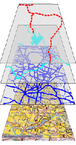
A Geographic Information System (GIS) is a computer software system that can be used to make maps and analyze geospatial data. Additional information on GIS is available from the U.S. Geological Survey and ESRI, a GIS software producer.
View a Power Point presentation with examples of maps produced with GIS.
GIS Software
Computers in the Government, Legal, Spatial, and Data Services Unit are equipped with GIS software that can be used to create maps with spatial data and analyze data. GIS software is also available on computers in the Malpass Library 2nd and 3rd Floor Computer Classrooms. Geographic Information System (GIS) services are available during the day or by appointment.
The Government Information and Data Services Librarian can help users identify, select, access and format data for use with GIS, and assist with basic GIS functions and techniques. GIS software in the Libraries is available for research and instructional use only. Non-educational (i.e. commercial) use is prohibited by our site license. Individual users may not store data and project files or load software on GIS workstations in the Collection.
Learning about GIS
Software manuals and books on GIS are available in the Library stacks and Map Reference collection. Use WestCat to search for books about geographic information systems or GIS.
The Government Information and Data Services Librarian can introduce Geographic Information System technologies and strategies for spatial data acquisition and formatting in a classroom setting. Please contact the Government Information Unit (309-298-2722) for more information.
Formal GIS classes are offered in the Geography, Biology and Agriculture Departments. The GIS courses taught at Western Illinois University include:
- Biology 452 Biological Applications of GIS (3)
- Geography 208 Cartographic Design for GIS (3)
- Geography 308 Introduction to GIS (3)
- Geography 408 Environmental Geographic Information Science (3)
- Geography 409 Thematic Geographic Information Science (3)
- Geography GEOG 508 GIS and Cartographic Design (3)
- Geography GEOG 509 Fundamentals of GIS Analysis (3)
- Agriculture 530 Topics Relating to Physical Science in Agriculture
ESRI, the company that produces the GIS software available on campus, provides online training through their virtual campus web site. Contact Kathy Barrett in UCSS for information on signing up for online courses.
GIS Services
The Western Illinois University Libraries' Government Information and Data Services Librarian will:
- Help users identify, locate access, format and use geospatial and statistical data.
- Provide library users with GIS software, hardware and data.
- Identify, acquire and provide access to geospatial and statistical data of interest to WIU students, faculty, staff, administrators and local users.
- Teach students, faculty and staff about geospatial and statistical data available in the Libraries or from other sources.
- Assist with use of GIS software and geospatial data by providing hands on assistance or the development of guides to accessing and using GIS software and data.
People who need assistance accessing or using GIS software and geospatial or statistical data may need to make an appointment. Please call 309-298-2723 for more information.
GIS Data
GIS Data is available from a number of sources, including local, US and State Government agencies and other sources. Historic Sanborn Fire Insurance maps are also available online through the WIU Libraries. The following sites might be useful for finding GIS data:
IllinoisIllinois Geospatial Data Clearinghouse - the clearinghouse for geospatial data for the state of Illinois. It can be used to download digital topographic maps (digital raster graphics), digital orthophotoquads, aerial photos and other data for for Ilinois.
Illinois Natural History Data - contains data on the boundaries of Federal & State lands in Illinois (including state parks, forests, conservation and fish & wildlife areas) as well as areas of potential archaeological significance and natural area inventories.
United States
National Map Small-Scale Collection - map data from the former National Atlas of the United States, which can be downloaded from the National Map website for use in GIS.
U.S. Census Bureau Cartographic Boundary Files - a site with cartographic boundary files for various Census geographic divisions.
National Historical GIS - The National Historical Geographic Information System (NHGIS) provides free census data and GIS-compatible boundary files for the entire United States from 1790 to 2000.
Atlas of Historical County Boundaries - provides maps, text and data about the creation and changes of the size, shape, and location of every county in the United States and the District of Columbia.
Geographic Names Information System - this site can be used to search for U.S. place names and identify the name of the topographic map(s) covering a given study area. It also offers links to the maps in the National Map.
Historic Topographic Maps - The U.S. Geological Survey has scanned current and historical topographic maps for the entire United States. They can be located and downloaded from the USGS Store Map Locator and Downloader.
Data.gov - provides information about and access to data, including geospatial data, developed by U.S. Government Agencies.
CropScape - provides access to current and historical cropland data layer. Allows users to interact with and explore data from current and historical cropland data layer data sets.
Multi-Resolution Land Characteristics Consortium Data Viewer - land cover viewer that can be used to display data on land cover and land use, which can be used for landscape analysis, land management, and runoff modeling.
EPA Basins - BASINS (Better Assessment Science Integrating point and Nonpoint Sources), is an environmental analysis system that includes models and data for watershed analysis and managment.
Adjoining States
Indiana Spatial Data Portal - GIS data for the state of Indiana.
Iowa Geographic Information Systems Library - GIS data for the state of Iowa.
Missouri Spatial Data Information Service - GIS data for the state of Missouri.
Wisconsin DNR GIS - GIS Data from the Wisconsin Department of Natural Resources.
