
WIU GIS Center Completes Critical Mapping for 9-1-1 Systems in All Illinois Counties
October 21, 2024
![[Download Print-Quality Image]](http://www.wiu.edu/images/news/20255/20255_13274_1.jpg)
MACOMB, IL— The Western Illinois University Geographic Information Systems (GIS) Center, under the leadership of Director Chad Sperry, has completed a critical project to ensure that all counties in Illinois, including Stark County, are now equipped with 9-1-1 services. This marks a significant milestone in public safety for the state.
Stark County, the last county in Illinois to establish 9-1-1 services, relied on the expertise of the WIU GIS Center to prepare and optimize the county's GIS data for geospatial routing of 9-1-1 calls. This collaborative effort, involving Peoria County's technical team and the WIU GIS Center, ensures more efficient emergency response services for Stark County residents and visitors.
"It was gratifying to be able to assist Stark County and the State of Illinois with critical GIS mapping for 9-1-1 applications," said Chad Sperry, director of the WIU GIS Center. "We worked with Sheriff Steven Sloan, David Tuttle and Cindy Barbera-Brelle, among others, to make this a reality."
"The consolidation of Stark County's 9-1-1 services is a significant achievement that demonstrates the power of teamwork," Cindy Barbera-Brelle, the Statewide 9-1-1 Administrator for the Illinois State Police, a WIU graduate and long-time supporter of the University, said. "Thanks to Peoria County's expert technical team and the dedicated efforts of the WIU GIS Center, Stark County is now equipped with a state-of-the-art 9-1-1 system. This collaboration ensures that both residents and visitors to Stark County will benefit from enhanced emergency response services."
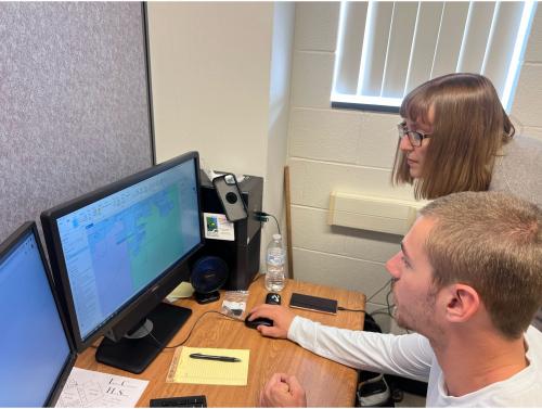
The GIS Center's role involved converting and editing key GIS layers, including roads, addresses and emergency boundaries. These GIS maps are now used by dispatchers and emergency personnel to locate individuals in need.
"Working at the GIS Center has provided numerous benefits that will help me in my future career," Brad Mercer, a student employee at the GIS Center, said. "I've worked on several projects and I try to help uphold our reputation as a reliable vendor for our clients. Personally, working here reinforced my decision to pursue a career in emergency management."
Echoing the benefits of this large project, Kale Campagna, another GIS student added, "I'm glad to have been a part of something meaningful. It's cool to see something that I've worked on be used by others. The experience has expanded my knowledge and expertise."
The completion of this project showcases WIU's expansion of the program to reach full public safety for the state and provides students with valuable, hands-on experience in GIS mapping.
For more information about the WIU GIS Center and its projects, visit wiu.edu/cas/gis_center/.
Posted By: University Communications (U-Communications@wiu.edu)
Office of University Communications & Marketing
Connect with us: